| |
| The Transportation Division of Yukon Infrastructure
provides current highway and ferry information. The Weather Network
also assembles information on current highway conditions and road construction in the Yukon Territory. |
 |
| |
| |
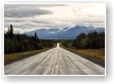
 |
Officially, the Alaska Highway begins in
Dawson Creek, British Columbia and ends in Delta Junction, Alaska, a distance of 1,390
miles. Unofficially, the Alcan terminates in Fairbanks, Alaska, 98 miles beyond
Delta Junction. From Contact Creek to Morley River, the paved two lane crosses the
Yukon - British Columbia border seven times before leaving the territory at Port Alcan.
Points of interest along the Yukon portion of the route include the Watson Lake
Sign Forest, Rancheria Falls, Miles Canyon, the SS Klondike, and Kluane Lake. |
|
| |
| |
 |
The 443 mile Klondike Highway connects
Skagway, Alaska with Dawson City. The all season paved highway enters the Yukon from
British Columbia at Windy Arm. Points on interest along the 393 mile Yukon portion
of the route include the Carcross Desert, Emerald Lake, Five Finger Rapids, Tintina
Trench, the Klondike Gold Fields, and Dawson City. |
|
| |
| |
 |
The 152 miles Haines Road (also known as
the Haines Cutoff) connects Haines, Alaska with Haines Junction. The all season
paved highway enters the Yukon from British Columbia nine miles south of Million Dollar
Falls. Points on interest along the 64 mile Yukon portion of the route include
Million Dollar Falls, Kathleen Lake, and Kluane National Park. |
|
| |
| |
 |
The 362 mile Campbell Highway connects
Watson Lake with the Klondike Highway (2 miles north of Carmacks). The all-season
road is gravel with the exception of two stretches totalling 55 miles. |
|
| |
| |
 |
The 456 mile Dempster Highway was
completed in 1978 and connects Inuvik, Northwest Territories with Dempster Corner on the
Klondike Highway (25 miles east of Dawson City). The road is gravel with the exception of
approximately five miles on either end. Points on interest along along the 289 mile
Yukon portion of the route include the Arctic Circle Crossing. |
|
| |
| |
 |
The 513 mile Canol Road was completed in
1944 and connected Norman Wells, Northwest Territories with Johnson's Crossing.
Currently, the seasonal gravel road is maintained from Johnson's Crossing to the Northwest
Territories border -- a distance of 286 miles. |
|
| |
| |
 |
The 79 mile Top Of the World Highway
connects Dawson City with Jack Wade Junction, Alaska. A free ferry crosses the Yukon
River at Dawson City. The 69 miles located within the Yukon are seal coated. The
road closes during the winter. |
|
| |
| |
 |
The 69 mile Silver Trail connects
Stewart Crossing to Keno City. The highway is paved from Stewart Crossing to Mayo --
a distance of 32 miles. The remainder of the road is gravel. Points of
interest include the Keno City Mining Museum. |
|
| |
| |
Approximate driving distances
by overland routes open year round |
 |
 |
 |
 |
 |
 |
 |
 |
 |
 |
| Anchorage, AK |
437 |
772 |
817 |
1038 |
623 |
961 |
941 |
836 |
1006 |
723 |
| Beaver Creek |
|
335 |
380 |
601 |
186 |
524 |
504 |
399 |
569 |
286 |
| Calgary, AB |
1734 |
1431 |
1558 |
1779 |
1548 |
1681 |
1395 |
1335 |
1165 |
1448 |
| Carcross |
335 |
|
159 |
380 |
149 |
303 |
201 |
96 |
266 |
49 |
| Carmacks |
380 |
159 |
|
221 |
194 |
144 |
142 |
223 |
393 |
110 |
| Dawson City |
601 |
380 |
221 |
|
415 |
143 |
363 |
444 |
614 |
331 |
| Dawson Creek, BC |
1201 |
898 |
1025 |
1246 |
1015 |
1169 |
862 |
802 |
632 |
915 |
| Edmonton, AB |
1561 |
1258 |
1385 |
1606 |
1375 |
1529 |
1222 |
1162 |
992 |
1275 |
| Fairbanks, AK |
320 |
655 |
700 |
921 |
506 |
844 |
824 |
719 |
889 |
606 |
| Fort Nelson, BC |
901 |
598 |
725 |
946 |
715 |
869 |
562 |
502 |
332 |
615 |
| Great Falls, MT |
2059 |
1756 |
1883 |
2104 |
1873 |
2027 |
1720 |
1660 |
1490 |
1773 |
| Haines, AK |
345 |
308 |
353 |
574 |
159 |
|
477 |
372 |
542 |
259 |
| Haines Junction |
186 |
149 |
194 |
415 |
|
338 |
318 |
213 |
383 |
100 |
| Inuvik, NT |
999 |
778 |
619 |
442 |
813 |
541 |
761 |
842 |
1012 |
729 |
| Mayo |
524 |
303 |
144 |
143 |
338 |
|
286 |
367 |
537 |
254 |
| Ross River |
504 |
201 |
142 |
363 |
318 |
286 |
|
171 |
230 |
218 |
| Seattle, WA |
1975 |
1672 |
1799 |
2020 |
1789 |
1943 |
1636 |
1576 |
1406 |
1689 |
| Skagway, AK |
397 |
62 |
221 |
442 |
211 |
365 |
263 |
158 |
328 |
111 |
| Teslin |
399 |
96 |
223 |
444 |
213 |
367 |
171 |
|
170 |
113 |
| Tok, AK |
112 |
447 |
492 |
713 |
298 |
636 |
616 |
511 |
681 |
398 |
| Watson Lake |
569 |
266 |
393 |
614 |
383 |
537 |
230 |
170 |
|
283 |
| Whitehorse |
286 |
49 |
110 |
331 |
100 |
254 |
218 |
113 |
283 |
|
| Yellowknife, NT |
1955 |
1652 |
1779 |
2000 |
1769 |
1923 |
1616 |
1556 |
1386 |
1669 |
| In certain instances, distances may
be shortened by utilizing summer only routes such as the Top Of The World Highway between
Dawson City, YT and the Taylor Highway. |
|
| |
|
About Us |
Contact Us |
Merchant Index |
Privacy Policy |
FAQ |
Site Map
|
| |
|
Copyright © 2003-06. Northern Outdoorsman in
association with Summit Solutions Ltd. & respective rights holders. All rights
reserved. Site design by Summit Solutions Ltd. Photos courtesy of Brian
Stein.
|
| Top ^ |
| |
|