| |
| Alaska
Department of Transportation & Public Facilities provides current road
conditions, weather information, and construction advisories through its traveler quick
links. The Alaska Marine Highway System
provides ferry transportation to numerous communities. |
 |
| |
| |
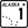 |
The 189 mile Glenn Highway connects
Anchorage and Glennallen. Points on interest along the all season, paved route
include Matanuska Glacier and the Eagle River Nature Center. |
|
| |
| |
 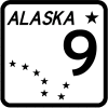 |
The 127 mile Seward Highway extends from
Anchorage to Seward. Points on interest along the all season, paved route include
Mount Alyeska, Portage Glacier, and Kenai Fjords National Park. |
|
| |
| |
 |
The 90 mile Sterling Highway connects
the Seward Highway (90 miles south of Anchorage) with Homer. Points on
interest along the all season, paved route on the Kenai Peninsula include the Kenai
National Wildlife Refuge, the Kenai River, and the Homer Spit. |
|
| |
| |
 |
The 125 mile Tok Cutoff connects Tok and
Gakona Junction. Points of interest along the all season, paved route include
Wrangell-St. Elias National Park and Preserve. |
|
| |
| |
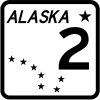 |
Officially, the Alaska Highway begins in
Dawson Creek, British Columbia and ends in Delta Junction, Alaska, a distance of 1,390
miles. Unofficially, the Alcan terminates in Fairbanks, Alaska, 98 miles beyond
Delta Junction. The paved highway enters Alaska at Port Alcan, 200 miles from Delta
Junction. Points of interest along the Alaska portion of the route include the
Trans-Alaska Pipeline Crossing. |
|
| |
| |
 |
The 152 mile Elliot Highway extends from
Fox to Manley Hot Springs. The first 30 miles of the road from Fox are paved, while
the rest is gravel. Points on interest along the all season route include Minto
Lakes and Manley Hot Springs. |
|
| |
| |
 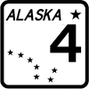 |
The 366 mile Richardson Highway connects
Valdez and Fairbanks. Points on interest along the all season, paved route
include North Pole, Worthington Glacier, Thompson Pass, Keystone Canyon, and the
Trans-Alaska Pipeline. |
|
| |
| |
 |
The 362 mile George Parks Highway was
completed in 1971 and connects Anchorage and Fairbanks. Points on
interest along the all season, paved route include Denali National Park and the Iditarod
Headquarters. |
|
| |
| |
 |
The 160 mile Taylor Highway connects
Eagle with Tetlin Junction on the Alaska Highway. Approximately 45 miles of
the road between Tetlin Junction and Chicken are paved. Points of interest along the
seasonal route include Fort Egbert. |
|
| |
| |
 |
The 162 mile Steese Highway extends from
Fairbanks to Circle. The first 44 miles of the road from Fairbanks are paved, while
the rest is gravel. Points on interest along the all season route include the Yukon
River, Circle Hot Springs, Davidson Ditch, and the Nome Creek Valley. |
|
| |
| |
 |
The 152 miles Haines Road (also known as
the Haines Cutoff) connects Haines with Haines Junction, Yukon. The all season paved
highway enters Alaska from British Columbia at Dalton Cache. Points on interest
along along the 41 mile Alaska portion of the route include the Alaska Chilkat Bald Eagle
Preserve. |
|
| |
| |
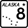 |
The 134 mile Denali Highway was
completed in 1957 connects the Cantwell and with Paxson. Most of the road is
gravel with the exception of 21 miles west of Paxson which is paved Points on
interest along the seasonal route include Tangle Lakes. |
|
| |
| |
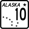 |
The 49 mile Copper River Highway extends
from Cordova to the Million Dollar Bridge. Construction began in 1945 with plans to
extend the highway to Chitina, but the 1964 Good Friday earthquake severely damaged the
roadbed and numerous bridges. The first 12 miles of the road from Cordova are paved,
while the rest is gravel. Points on interest along the all season route include the
Copper River Delta. |
|
| |
| |
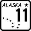 |
The 414 mile Dalton Highway extends from
the Elliot Highway to Deadhorse. Points on interest along the all season, gravel
route include the Arctic Circle and the Trans-Alaska Pipeline. |
|
| |
| |
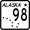 |
The 443 mile Klondike Highway connects
Skagway with Dawson City, Yukon. The all season paved highway enters Alaska at White
Pass. Points on interest along along the 15 mile Alaska portion of the route include
the Klondike Gold Rush National Historic Park and Skagway. |
|
| |
| |
Approximate driving distances
by overland routes open year round |
 |
 |
 |
 |
 |
 |
 |
 |
 |
 |
 |
| Anchorage |
|
507 |
498 |
360 |
782 |
225 |
825 |
127 |
834 |
325 |
304 |
| Calgary, AB |
2171 |
2201 |
1993 |
2054 |
1707 |
2396 |
2519 |
2298 |
1493 |
1846 |
2097 |
| Circle |
507 |
|
528 |
147 |
812 |
732 |
600 |
634 |
864 |
355 |
513 |
| Dawson City, YT |
1038 |
1068 |
860 |
921 |
574 |
1263 |
1386 |
1165 |
442 |
713 |
964 |
| Dawson Creek, BC |
1638 |
1668 |
1460 |
1521 |
1174 |
1863 |
1986 |
1765 |
960 |
1313 |
1564 |
| Eagle |
498 |
528 |
|
381 |
604 |
723 |
846 |
625 |
656 |
173 |
424 |
| Edmonton, AB |
1998 |
2028 |
1820 |
1881 |
1534 |
2223 |
2346 |
2125 |
1320 |
1673 |
1924 |
| Fairbanks |
360 |
147 |
381 |
|
665 |
585 |
465 |
487 |
717 |
208 |
366 |
| Great Falls, MT |
2496 |
2526 |
2318 |
2379 |
2032 |
2721 |
2844 |
2623 |
1818 |
2171 |
2422 |
| Haines |
782 |
812 |
604 |
665 |
|
1007 |
1130 |
909 |
370 |
457 |
708 |
| Homer |
225 |
732 |
723 |
585 |
1007 |
|
1050 |
174 |
1059 |
550 |
529 |
| Prince Rupert, BC |
1600 |
1630 |
1422 |
1483 |
1136 |
1825 |
1948 |
1727 |
922 |
1275 |
1526 |
| Prudhoe Bay |
825 |
600 |
846 |
465 |
1130 |
1050 |
|
952 |
1182 |
673 |
831 |
| Seattle, WA |
2412 |
2442 |
2234 |
2295 |
1948 |
2637 |
2760 |
2539 |
1734 |
2087 |
2338 |
| Seward |
127 |
634 |
625 |
487 |
909 |
174 |
952 |
|
961 |
452 |
431 |
| Skagway |
834 |
864 |
656 |
717 |
370 |
1059 |
1182 |
961 |
|
509 |
760 |
| Tok |
325 |
355 |
173 |
208 |
457 |
550 |
673 |
452 |
509 |
|
251 |
| Valdez |
304 |
513 |
424 |
366 |
708 |
529 |
831 |
430 |
760 |
251 |
|
| Whitehorse, YT |
723 |
753 |
545 |
606 |
259 |
948 |
1071 |
850 |
111 |
398 |
649 |
| Yellowknife, NT |
2140 |
2170 |
1962 |
2023 |
1676 |
2365 |
2488 |
2267 |
1528 |
1813 |
2066 |
| In certain instances, distances may be shortened
by utilizing summer only routes such as the Top Of The World Highway between Dawson City,
YT and the Taylor Highway. |
|
| |
|
About Us |
Contact Us |
Merchant Index |
Privacy Policy |
FAQ |
Site Map
|
| |
|
Copyright © 2003-06. Northern Outdoorsman in
association with Summit Solutions Ltd. & respective rights holders. All rights
reserved. Site design by Summit Solutions Ltd. Photos courtesy of Brian
Stein.
|
| Top ^ |
| |
